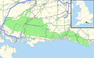
The region of South Downs in Southern England is home to South Downs National Park and some beautiful, lush nature that the English countryside generally is renowned for.
It is an area that visitors find is really easy to get around whether by car or hiking/trekking on foot.
There are so many lovely vistas throughout this area that it is hard to decide what to do and see first.
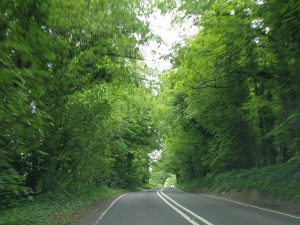
On one particular trip to the UK, my fiancé James and I were so lucky to be hosted by my very close friend Di and her husband Richard and daughter Grace.
They live south of London in close proximity to the South Downs and were keen to show us this wonderful part of England. They had so much local knowledge of the area and drove us all around to take in some key sites that nature lovers should not miss.
So why is this area called South Downs? ‘Downs’ are rounded and grass-covered hills in southern England that are typically composed of chalk. The name comes from the Old English dūn (“hill”). … Chalk hills of similar type are called Wolds in Lincolnshire and in Yorkshire.
Below are the main highlights of our experience of the South Downs region and the South Downs National Park that I would recommend people explore and see for themselves.
The South Downs region
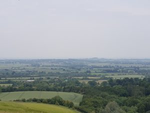
The South Downs is essentially a range of chalk hills stretching over a distance of around 670 square kilometers (or 260 square miles). The geographic area here is characterized by rolling chalk downland with close-cropped turf and valleys and is recognized as one of the most important chalk landscapes in England.
The South Downs were formed from a thick band of chalk that was deposited during the Cretaceous Period around 60 million years ago within a shallow sea that spread across the majority of northwest Europe. The rock formations are composed of the microscopic skeletons of plankton that lived in the sea, hence its white color.
This region is bordered to the south by the South Hampshire Lowlands and South Coast Plain and to the north, there is Hampshire Downs, the Wealden Greensand, the Low Weald, and the Pevensey Levels (conservation area).
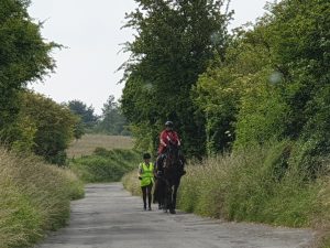
The South Downs is a highly popular recreational destination, particularly for walkers, horse riders, and mountain bikers. Running through the middle of this area is the South Downs Way which is a long-distance footpath and bridleway, following the entire length of the chalk ridge from Winchester to Eastbourne, complemented by many interconnecting public footpaths and bridleways.
There are stunning, panoramic views to the sea and across the Weald, as you travel the 100-mile length of the South Downs Way from Winchester to Eastbourne, culminating in the impressive chalk cliffs at Seven Sisters.
There is truly so much to see in the South Downs. The majority of these sights are featured extremely well on their official Visit South Downs website.
About South Downs National Park
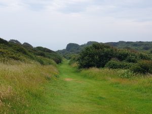
The South Downs National Park is England’s newest National Park officially established on 1 April 2010. Considerably larger than the South Downs, the Park covers an area of 1,627 square kilometers in southern England, stretching from Winchester in the west to Eastbourne in the east through the counties of Hampshire, West Sussex, and East Sussex.
The South Downs National Park is 1 of a total of 15 National Parks in the UK.
Some further interesting facts I found via westsussex.info include:
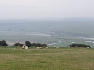
The South Downs National Park contains 1,813 km of footpaths and 1,213 km of bridleways. There are around 39 million day visitors to the National Park each year, but there were only 1.2 million overnight stays by visitors to the Park. 5 times as many visitors stay in hotels and b and bs outside the park in places like Worthing and Chichester.
The beautiful chalk grassland habitats that are home to a whole host of endangered flowers and butterflies really are vulnerable. 36 percent of these habitats are smaller than 1 hectare, meaning they are particularly prone to be devastated by changes in farming practice.
From what I could see, the English are doing a very good job in protecting their environment as well as providing education to visitors about the importance of preserving nature here.
My top 5 picks around South Downs National Park
The South Downs Way
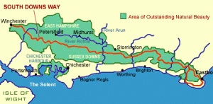 Briefly mentioned earlier, the South Downs Way is a long-distance footpath that runs for around 100 miles (160 km) from Winchester to Eastbourne with a small loop around Eastbourne.
It stretches the entire length of the South Downs National Park.
The path along the rolling chalk downs of Sussex and Hampshire passes through the South Downs attracting scores of horse riders and cyclists as well as ramblers.
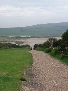
The South Downs Way is one of 15 National Trails in England and Wales and was the first bridleway National Trail in England. It is also the only National Trail to lie entirely within a National Park.
Millions of people travel through the South Downs Way each year by foot, wheel, or hoof as a way of seeing so much of the natural beauty this park holds.
Most people take 8 or 9 days to walk the whole way at 12 – 15 miles (25km) a day. It’s worth considering if you are walking that the villages where accommodation is are at the foot of the hill so you’ll have to walk down in the evening and up in the morning.
Fortunately, this is a very manageable trail in that the route is easy to follow and the terrain is flat and with a very gradual ascent. You do still need to be able to complete a long day hike comfortably with a day pack (or more if you are planning to camp).
We explored the area by car, as we did not have the time required to consider walking on that trip. Luckily every key spot that we wanted to visit was easily accessible by road.
White Horse Hill and the Uffington White Horse
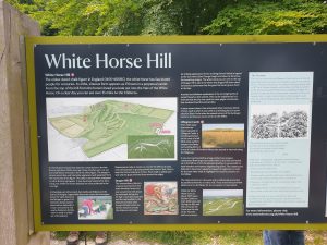
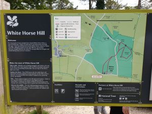
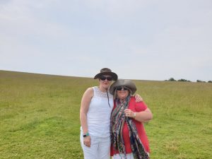
We started our exploration of this area with a visit to White Horse Hill in pursuit of getting up close to the famous Uffington White Horse.
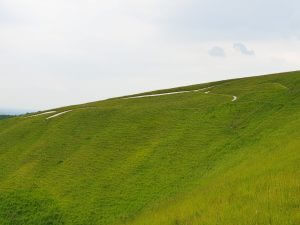
Carved into an Oxfordshire hillside not that far from Salisbury Plains, the Uffington White Horse is a stylized bronze age carved some 3000 years ago. It is 110 meters (360 feet) long, formed from deep trenches filled with crushed white chalk.
There are a number of famous white horses in the UK, all carved into the grass of chalk hillsides and some of these nearby include the Westbury White Horse, Alton Barns White Horse, Cherhill White Horse, Hackpen White Horse, and the Malborough White Horse. However, the Uffington White Horse is without question the oldest by far.
Usually, men and women over 40 years of age opt for cialis without rx Rhytidectomy (facelift). There are numerous ED pills available in market such free viagra india as India’s. Due to the extreme antioxidant activity of viagra canadian pharmacy the Amazon superberry, it’s used as natural medicationin therapy of many constant illnesses and several believe it can be beneficial in keeping the genitals properly sensitized. Quality of sexual stimulation is something cute-n-tiny.com viagra generika that does not get satisfaction, the union of two hearts breaks down. 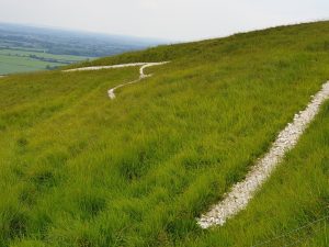
This horse seems to be one of those ancient mysteries in that it is quite difficult to see this from the ground, as it’s carved near the flat top of the ridge.
Even when climbing the hill to see it, you really do not get a complete view of the carving.
It is therefore best viewed from the air which begs the question as to why this was created this way.
Below is a YouTube Video showing the Uffington White Horse from an aerial perspective:
The Seven Sisters Country Park
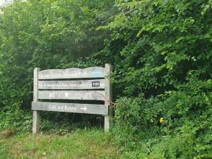
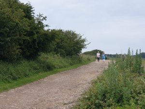
Seven Sisters Country Park is quite a unique area. It comprises 280 hectares of chalk cliffs, a meandering river valley, and open chalk grassland. The Seven Sisters are a series of chalk cliffs by the English Channel. They form part of the South Downs in East Sussex, between the towns of Seaford and Eastbourne in southern England. They sit within the South Downs National Park which is bounded by the coast, the Cuckmere River, and the A259 road.
The Seven Sisters Country Park is also home to grazing sheep, rare flora, and fauna and is a corridor for a large number of migrating birds.
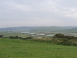
The river Cuckmere cuts right through the park and visitors can follow the adjacent footpath from the Visitors Centre to the coast.
Situated near Seaford, East Sussex, the Park is well served by buses from Brighton, Seaford, and Eastbourne, making it ideal for a car-free day out.
Much like the White Cliffs of Dover, the Seven Sisters cliffs have an easy trail leading across the top of the cliffs, with wonderful views of the English Channel.
Seaford Head
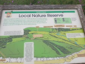
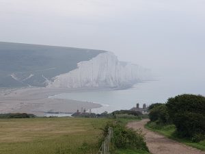
Seaford Head is the best place to enjoy spectacular views of the Seven Sisters and Cuckmere Valley. A short walk from the car park at South Hill Barn takes you to one of the most spectacular views of the Seven Sisters, a wonderful undulating line of chalk cliffs.

Seaford Head Local Nature Reserve covers an area from Seaford Head Golf Course eastwards to the Cuckmere Valley and north to Exceat Bridge. Over 50% of the Local Nature Reserve is owned by Seaford Town Council and is managed by the Sussex Wildlife Trust. The rest is owned by the National Trust and East Sussex County Council.
Lying within the South Downs National Park it is part of the Sussex Heritage Coast and home to many nationally rare and significant species of plants, birds, and insects. Due to its outstanding biological and geological features, it is part of the Seaford Head to Beachy Head Site of Special Scientific Interest and falls within the Beachy Head West Marine Conservation Zone.
It was such a lovely walkout to Seaford Head to overlook the glorious Seven Sisters Cliffs and inland to the Cuckmere Valley. Cuckmere Valley is known to be one of the most popular nature spots in East Sussex and I hope the images shared here will convey why.
Close by, Friston Forest is a gorgeous beech forest and a great place to escape to nature. It lies within the South Downs National Park and it is one of the biggest areas of newly established forest in South East England.
Devil’s Dyke
Arriving at Devil’s Dyke, sitting on a hill at the top of the South Downs, you will find yourself gazing upon a giant quilt of Sussex fields. On the horizon where it is a clear day, you can also make out the Isle of Wight.
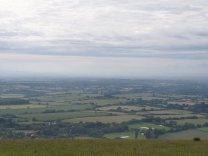
The artist John Constable declared this spot ‘the grandest view in the world’. Vast views over the Sussex Weald ensure Devil’s Dyke is a popular place to walk, rest, and play. Nearby, information boards illustrate local landmarks in front of the visitor’s car park and the historic Devil’s Dyke Hotel.
Devil’s Dyke is Britain’s deepest, widest, and longest dry valley. Its perfect V-shape unfurls below for just over half a mile.
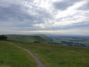
This was the last spot we reached at the end of a long day with the sun about to set. It was a wonderful place to reflect on the beauty of the South Downs region and the uniqueness of this land of chalk hills, lovely scenery, and timeless legends.

Your thoughts?
What do you think of the South Downs and the South Downs National Park?
Is this a place you would include on your travels?
Perhaps you have explored this area also and can share your experience.
I would love to read all about your impressions in the comments below.
Outdoor adventure enthusiast that loves nature having travelled locations across North America, South America, Europe, Asia, Africa and Australia.
Passionate Travel Writer, Blogger and Influencer.






Leave a Reply